
Thomas van Laake, Universidad de Manchester. Instagram: @vanLaakeT Instagram: tvlaake
Fecha de captura: Ciudad de México, septiembre 2022 a marzo 2023. Toronto, abril 2023 a agosto 2023.
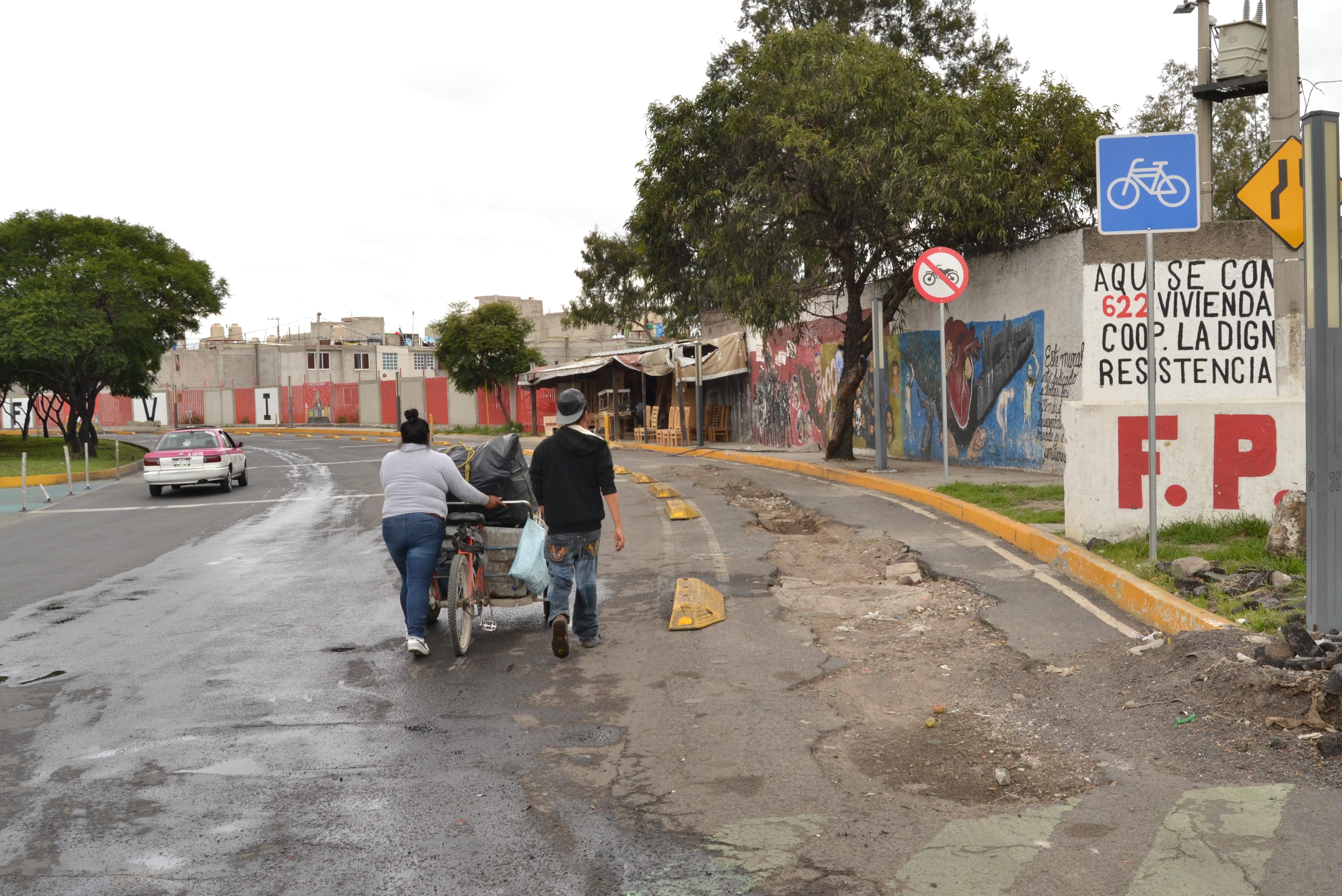

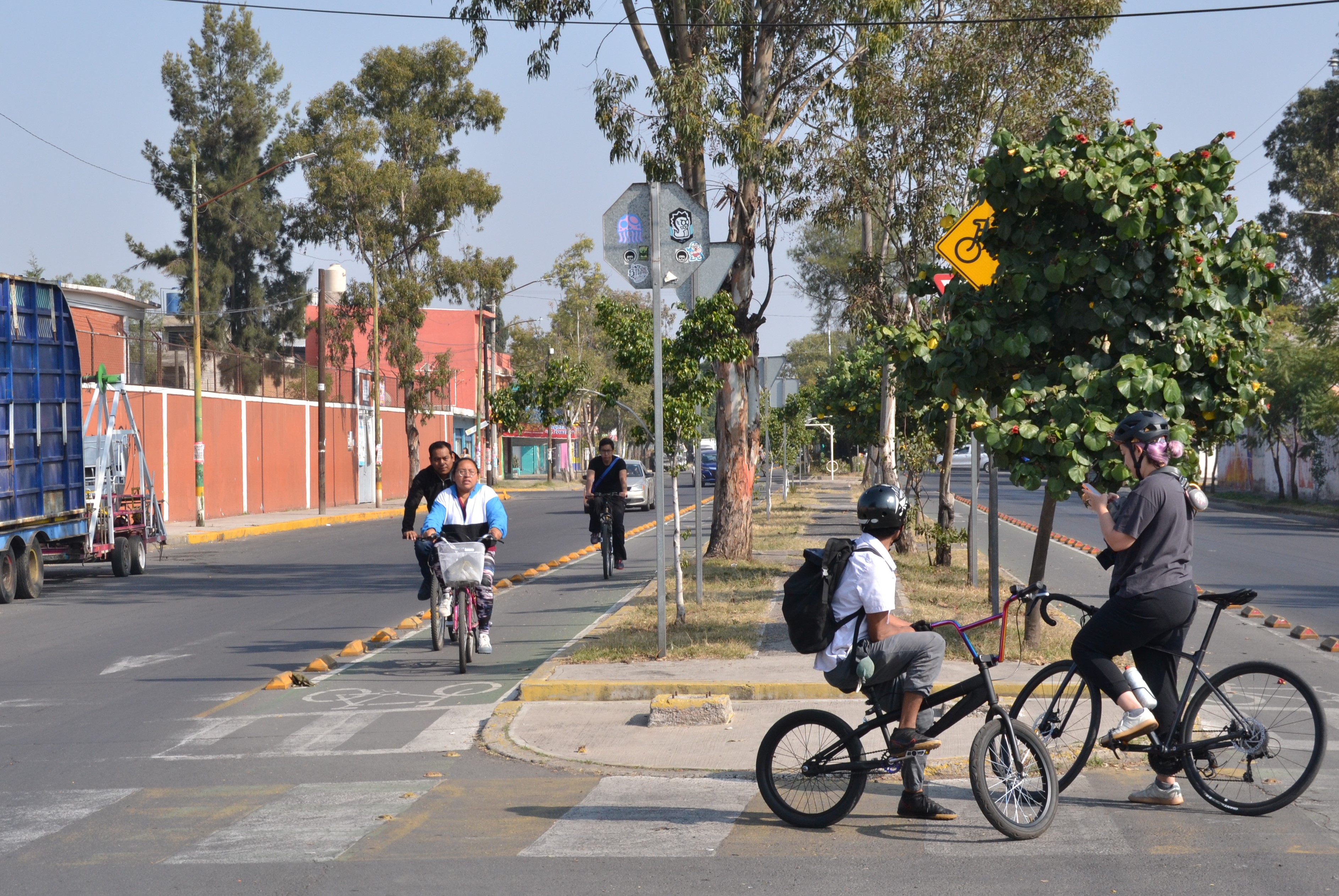
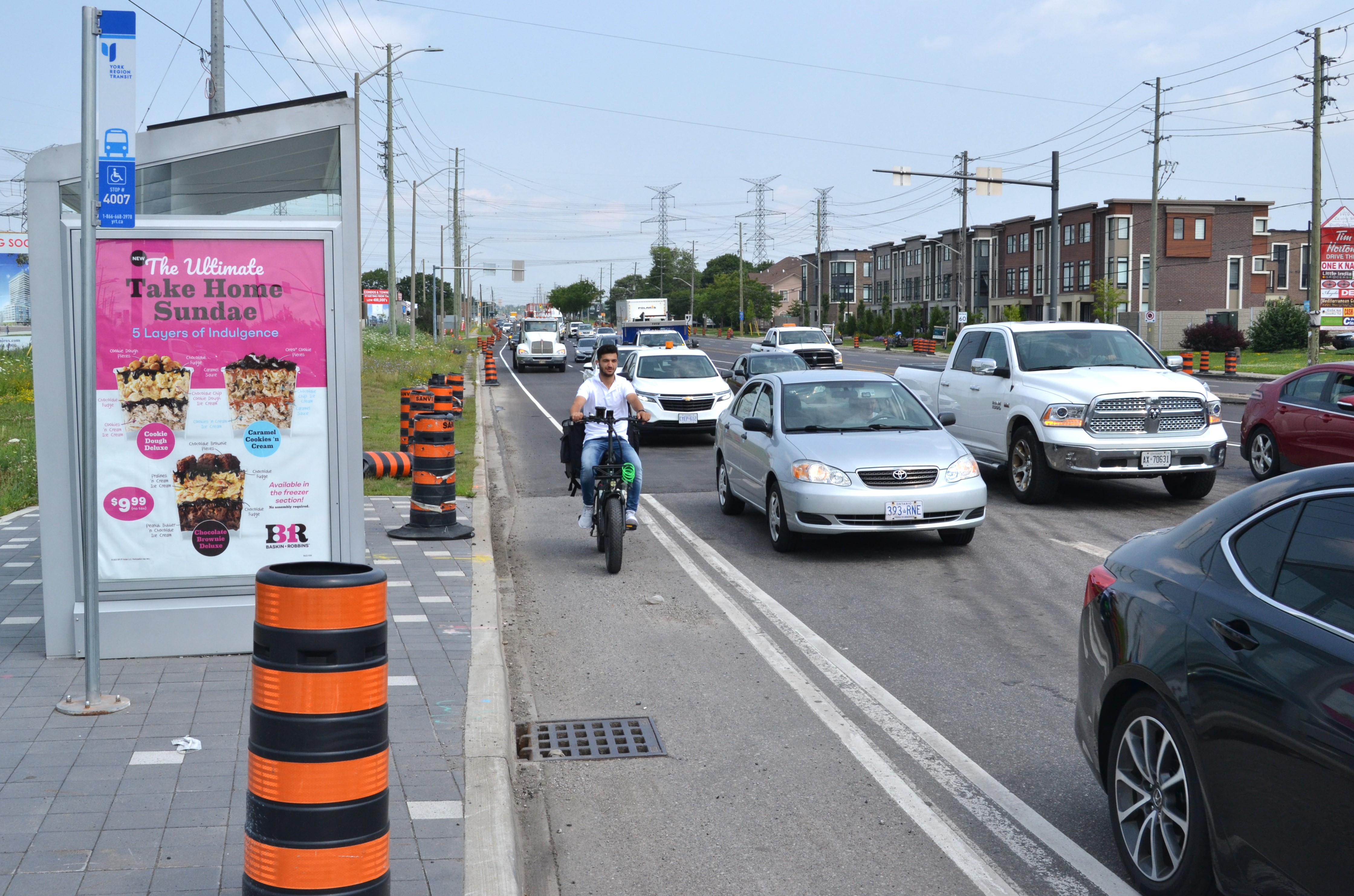

Nombre de las fotos: 1) Ciclovía sin mantenimiento en Eje 5, Iztapalapa (CDMX). 2) Ciclista entrena sobre ciclovía suburbana en una urbanización nueva en Kleinburg (Región de York, Ontario). 3) Ciclovías de Ciudad Nezahualcóyotl (Estado de México). 4) Repartidor circula en bicicleta eléctrica sobre una ciclovía pintada en una arteria primaria en Vaughan (Región de York, Ontario). 5) Repartidor circula a contravía al lado de una ciclovía invadida por estacionamiento en Tláhuac (CDMX).
Estas fotografías, tomadas durante visitas de campo a infraestructura ciclista periférica en estadías de investigación en la Ciudad de México y Toronto, representan algunas de las problemáticas, paradojas, y dificultades de las políticas y programas de expansión de redes ciclistas en estos territorios urbanos heterogéneos. Aunque puede ser obvio que metrópolis en otros extremos del continente difieren muchísimo, hay importantes coincidencias entre sus programas de mejoramiento de redes ciclistas, los cuales enfrentan el reto de expandir más allá de la zona central de la urbe e influir en las movilidades y formas urbanas periféricas. Estos ‘nuevos’ contextos para proyectos de infraestructura ciclista –sea el anillo de suburbios alrededor de Toronto o las urbanizaciones informales en los bordes de la Ciudad de México– ponen los establecidos modelos de reconfiguración infraestructural a prueba y hacen reflexionar sobre la adecuación de formas de gobernanza y procesos de ordenamiento a territorios heterogéneos.
¿Por qué son importantes estas fotografías en particular para su investigación?
Mi proyecto de investigación, que trata de la expansión y mejora de infraestructura ciclista en áreas metropolitanas complejas y generalmente hostiles para la bicicleta, me permite combinar mis intereses en geografía, ciclismo, y fotografía. Practico la fotografía principalmente durante recorridos en bicicleta, a veces por gusto propio, pero también por fines investigativos en conjunto con visitas de campo. Las imágenes que tomo son principalmente técnicos: variaciones en las configuraciones de ciclovías, estaciones de bicicleta pública o parqueaderos, situaciones problemáticas o peligrosas en la vía, etcétera. No obstante, las fotografías más impactantes son las que retratan personas interactuando con la infraestructura y su contexto. Son imágenes que me devuelvan al sitio de investigación y que simbolizan las dinámicas que busco problematizar. ¡Además, mejoran sustancialmente mis presentaciones!
Cycling infrastructure on the peripheries of Mexico City and Toronto
Thomas van Laake, University of Manchester. Twitter: @vanLaakeT Instagram: tvlaake
Date: Mexico City, September 2022 to March 2023. Toronto, April 2023 to August 2023.
Name of the pictures: 1) Poorly maintained bicycle lane in Iztapalapa (Mexico City). 2) Road cyclist training on a cycle track through a new suburban development in Kleinburg (York Region, Ontario). 3) Bicycle lanes of Ciudad Nezahualcóyotl (State of México). 4) Delivery worker on an e-bike using a painted bicycle lane along a major artery in Vaughan (York Region, Ontario). 5) Delivery worker riding against the direction of traffic, next to a bicycle lane occupied by parking in Tláhuac (Mexico City).
These photographs, taken during field visits to peripheral cycling infrastructure during research stays in Mexico City and Toronto, represent some of the problems, paradoxes, and difficulties faced by policies and programs to expand cycling networks in these heterogeneous urban territories. Although the differences between these metropolises at other ends of the continent may be obvious, there coincide in featuring programs to improve cycling networks, and in facing the challenge of expanding beyond the central area of the city and operating within distinct mobility patterns and urban forms. These ‘new’, peripheral contexts for cycling infrastructure projects –be they Toronto’s ring of suburbs, or the informal urbanization on the edges of Mexico City– test the limits of established models of infrastructural reconfiguration and force us to reflect on the adaptation of forms of governance and ordering processes to the heterogeneous territories they operate in.
Why are those particular photographs important to your research?
My research project, which deals with the expansion and improvement of cycling infrastructure in complex and generally bicycle-unfriendly metropolitan areas, allows me to combine my interests in geography, cycling, and photography. I practice photography mainly during cycling excursions, sometimes for my own pleasure, but also for research purposes (in conjunction with field visits). The images I take generally focus on technical aspects: variations in the configurations of bike lanes, public bike stations or parking lots, problematic or dangerous situations on the road, etc. However, the most striking photographs are those that portray people interacting with infrastructure and its context. Looking back at these images, they return me to my research sites and symbolize the dynamics that I seek to problematize. Plus, they substantially improve my presentations!
